Every August, Oregon's fire season scorches tens of thousands of acres across the Cascades, Blues, and eastern high desert. Most people see smoke columns and road closures. Experienced elk hunters see opportunity. The relationship between wildfire and elk habitat is well-documented in wildlife biology—and once you understand it, you'll start looking at burn maps with the same attention you'd give to topo lines and water sources.
Why Elk Love Burns
Bull elk are grazers as much as browsers, and nothing triggers explosive forage growth like fire. Within the first summer after a moderate-intensity burn, forbs, grasses, and young shrub shoots emerge from nutrient-rich ash-bed soils with a density and protein content that undisturbed forest can't match. Elk know this instinctively. Trail cameras placed on burn edges within weeks of a fire show immediate use—cows and calves first, then bulls following the groceries.
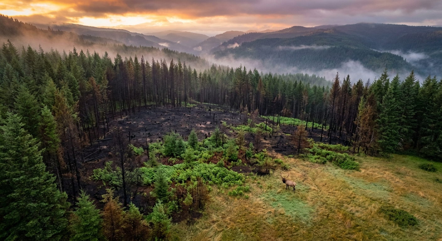
The sweet spot for elk hunting a burn isn't the first summer—it's years two through five. By then, the cheatgrass competition has been outcompeted by native forbs, the shrub layer is knee to waist high (perfect for browsing), and the burned snags provide shade and visual cover elk prefer when feeding in daylight. Year-two burns with adjacent standing timber for thermal cover and bedding are the combination to look for on a map.
Reading USFS Fire Maps Before the Season
Oregon's National Forests post fire perimeter maps and burn intensity data through InciWeb and the USFS Geospatial Data portal. Download shapefiles and import them into OnX Hunt—you can overlay burn perimeters directly on top of your unit maps. Here's what to look for:
- Moderate-intensity patches within high-intensity burns: High-intensity burns where crowns torched out create snag fields. Moderate patches inside those perimeters retain root systems and produce the fastest and best early forage. Look for patchwork burn patterns.
- South and east-facing slopes: These get more sun, dry out faster, and produce more diverse forb growth. They're also the slopes elk use as primary winter range, which means established trails and familiar travel corridors.
- Edge habitat: The boundary between burned and unburned timber is often the highest-traffic zone. Bulls bed in standing timber, feed in the burn, and move the transition at dawn and dusk. Set up to intercept that movement.
- Water proximity: Fire doesn't destroy springs, seeps, or creeks—it just removes the canopy shade. In the year or two after a burn, water sources that were previously hidden in thick timber become visible on satellite imagery. They'll be heavily used.
Navigating Temporary Closures
The complication with fire-season elk hunting is closures. USFS and BLM issue emergency area closures around active fire operations, and those closures can persist through the fall season if hazard trees, debris, or infrastructure damage warrant. Check with the ranger district managing your unit before committing to a burn area—call the district office directly rather than relying on closure postings that may not be current. Also check road status, because dozer lines and suppression roads can make previously roadless areas suddenly accessible, which changes hunting pressure dynamics entirely.
2025 Burns to Watch for Oregon's 2026 Season
Several significant fires burned in Oregon's elk country during 2025. Without naming specific closures that may still be in effect, key fire zones to investigate for 2026 access include areas within the Malheur National Forest (Grant County), the southern Wallowa-Whitman, and portions of the Winema and Fremont National Forests in Klamath and Lake counties. Each of these experienced meaningful acreage in the moderate-severity range—exactly the condition that should produce exceptional forage and elk use by September 2026.
Use the MTBS (Monitoring Trends in Burn Severity) data portal to pull fire severity maps for 2025 burns. The color-coded burn severity classifications (low, moderate, high) will tell you exactly which patches had the right intensity to promote the forage response you're hunting for.
Scouting a Burn in July and August
Don't wait until September to see a burn for the first time. Get in there during summer if access allows. Walk the burn edges at first light and look for:
- Fresh tracks in ash-covered soil
- Wallows in adjacent riparian areas (bulls wallow heavily in pre-rut August)
- Browse lines on regenerating shrubs—shoulder height on young aspens means elk are there nightly
- Trails leading from standing timber into the burn, oriented toward the prevailing downhill thermal
- Beds in thick downed timber within the burn perimeter
If you're glassing from above, spend time on south-facing slopes with your spotting scope from a distance before moving in. September bulls move at first light and last light and are largely invisible midday. The biggest mistake hunters make in burns is jumping in too fast and blowing elk out with their scent before they understand the travel patterns.
Tactical Setup in Burned Country
Calling in a burned landscape presents unique challenges. Bugling carries farther without canopy absorption, which is useful for locating bulls at distance but means your calls also educate every elk in the basin. Use cow calls as your primary locate tool—they're less alarming than bull bugles to satellite bulls and cows. When a bull bugles back, move aggressively toward him only if the wind is perfect. In open burn terrain, thermals are your enemy; they swirl and switch as heated air rises off dark soil. Hunt primarily in the first and last 90 minutes of light when thermals are more predictable.
Shooting lanes are typically better in burns than in closed-canopy forest—but downed timber creates obstacles for stalking. Move slowly, place each foot carefully, and plan your approach route with the terrain in mind before committing. The open sight lines that make burns productive also mean elk can see you just as easily as you can see them.
The Long Game
The hunters who consistently kill elk in Oregon's burned landscapes treat it as a multi-year project. They map the burns, return every summer to watch how the habitat evolves, and build a library of knowledge about how specific terrain features and forage types produce at different stages of post-fire succession. That kind of patient, systematic scouting is what separates hunters who stumble into a burn and get lucky from hunters who return to the same burned ridge every September because they know exactly what's there.