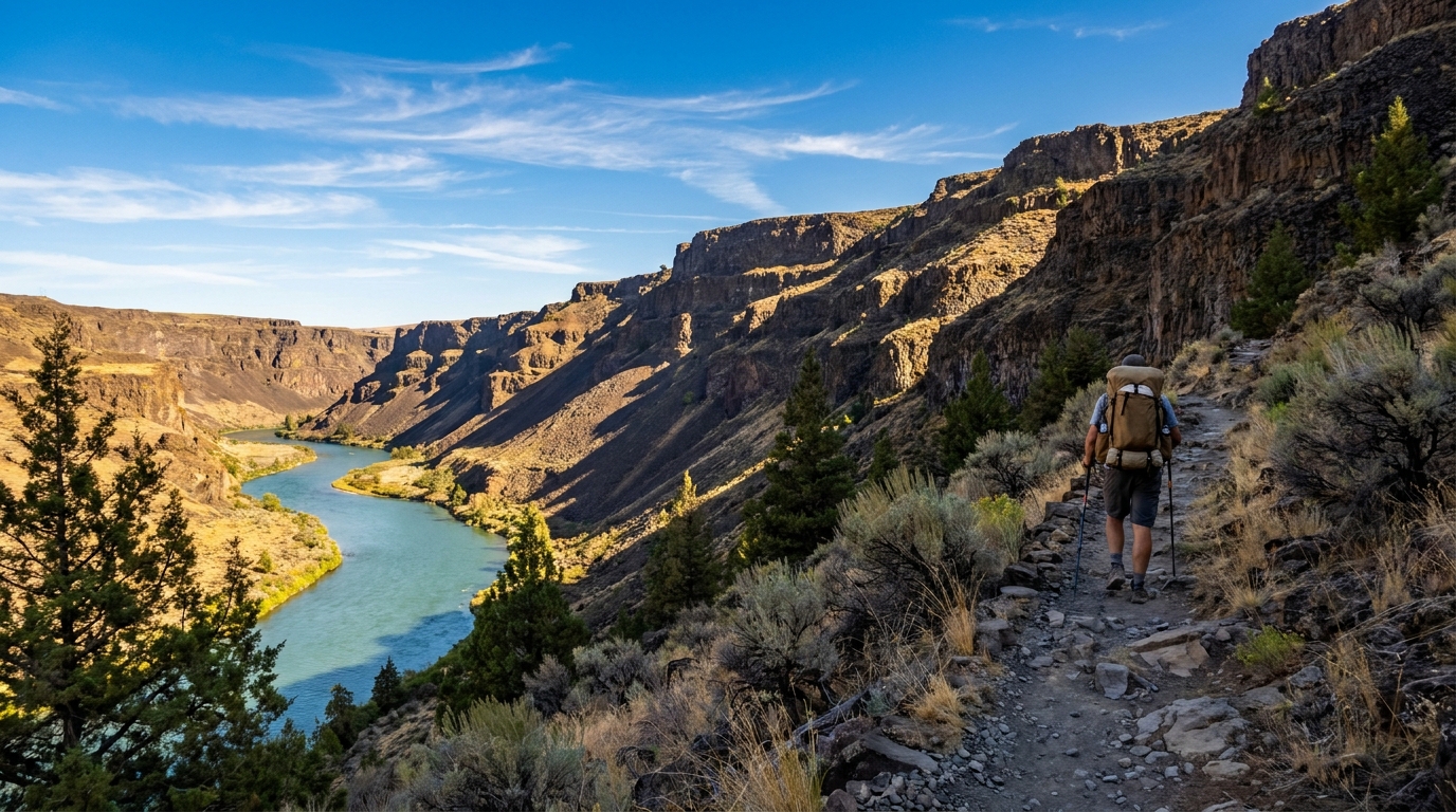
When Oregon backpackers think desert canyon hiking, they usually think of the Owyhee, the John Day, or the Rogue. The Lower Deschutes River rarely makes the list — which is puzzling, because the 25-plus miles of trail running through the canyon from Maupin to the Columbia River offers some of the most dramatic, accessible, and rewarding desert backpacking in the state. Add the fact that the river is a blue-ribbon fishery and you've got a route that works equally well as a fishing backpack trip or a pure canyon experience.
The Route
The primary trail follows the east bank of the Deschutes from Maupin south, or the west bank from the Columbia trailhead north — depending on your preferred direction of travel. Most backpackers run a car shuttle and hike point-to-point from Maupin downstream to Heritage Landing at the river mouth, a distance of roughly 25 miles on the east bank route. The terrain is manageable — the canyon is steep-walled and dramatic, but the trail itself stays close to the river grade and doesn't involve serious elevation gain. Total accumulated gain on the full route is modest, typically under 2,000 feet.
A 3-day, 2-night itinerary works well for most hikers:
- Day 1: Trailhead at Maupin to Sandy Beach or Long Bend — approximately 9 miles. Good established campsites in the first river bend complexes below town.
- Day 2: Sandy Beach to White River confluence area — approximately 8 miles. The middle section has the most dramatic canyon walls and best bird watching. Brown pelicans, osprey, and bald eagles are common.
- Day 3: White River to Heritage Landing at the Columbia — approximately 8 miles. The canyon opens gradually as you approach the Columbia. Strong downstream views for the last 4 miles.
Getting There and Shuttle Logistics
The south trailhead is in Maupin on the east side of the river, accessed via Highway 197 from The Dalles (45 minutes) or Bend (1.5 hours). The north terminus at Heritage Landing is off Highway 206 west of Wasco near Biggs Junction. Setting a car shuttle between these points takes about 1.5 hours of driving. Commercial shuttles aren't commonly offered for this route — coordinate with a second vehicle, or use the ferry at Sherars Falls to cross to the west bank and reduce shuttle complexity on some loop variations.
Water and Desert Conditions
The Deschutes is right there the whole way, but it's a swift, cold, Class III-IV river in sections and should be treated before drinking. Carry a reliable filter — Sawyer Squeeze or similar — and don't skip treatment. Side springs exist along the route but are not mapped reliably enough to count on.
Summer hiking on the Lower Deschutes means desert heat. July and August highs regularly exceed 95°F on the canyon floor. Beat the heat by hiking early — on the trail by 6 AM — and taking a long midday break in the shade. Canyon walls provide good shade by mid-afternoon, which makes evening hiking pleasant. Carry at minimum 3 liters of capacity. Sun protection is mandatory: hat, long sleeves, sunscreen. The canyon is shadeless for long stretches.
Rattlesnakes and Wildlife
Western Pacific rattlesnakes are present throughout the lower canyon. They're not aggressive but they're real — watch where you step and place your hands, especially in the morning when snakes sun themselves on warm rocks at trail's edge. Bighorn sheep are commonly seen on the canyon walls; mule deer are abundant near the river at dawn and dusk. Osprey nest on the canyon walls and are reliably entertaining to watch fish.
Permits and Regulations
The Lower Deschutes River corridor is managed jointly by ODFW and BLM. Camping is allowed at designated river campsites only — most are marked and have fire rings and sometimes pit toilets. A campfire permit is required (free, at the trailhead self-issue station). Check fire restrictions before you go — the canyon is under Stage 2 restrictions by mid-August most years, which means no fires regardless of permit.
Fishing in the Lower Deschutes is catch-and-release only for wild steelhead and requires a Combined Angling Tag. The summer steelhead run on this stretch (particularly Mack's Canyon to Sherar's Falls) is one of the most famous in Oregon — don't leave camp without a rod if you have the right tag.
Gear Considerations for Desert Canyon Backpacking
- Pack weight: Keep it light — you'll thank yourself in the afternoon heat. Target under 35 lbs with water and food.
- Footwear: Trail runners are ideal on this route. The trail is mostly rocky river cobble and hardpack — not technical enough to require boots, and the heat makes breathable low-cuts far more comfortable.
- Shelter: A lightweight tarp or bivy is fine in summer — weather is usually stable and dry. Bring a tarp anyway because canyon wind off the Columbia can pick up significantly in the lower 5 miles.
- Navigation: CalTopo and OnX both have the trail mapped well. Download offline maps — cell service is spotty through most of the canyon.
- Night temperatures: Don't underestimate desert nights. Even when daytime temps hit 95°F, canyon temperatures can drop to the low 50s by 3 AM. A 40°F-rated sleeping bag is appropriate for summer.
Why This Route Deserves More Attention
The Lower Deschutes canyon is world-class river scenery — 1,000-foot basalt walls, a turquoise river, and a night sky that's genuinely dark once you're a few miles below Maupin. The trail is well-maintained, the fishing opportunity is exceptional, and the permit situation is relaxed compared to the popular wilderness areas further into the Cascades. You're not competing for a permit-required campsite with 500 other applicants. You just show up, filter your water, and hike one of the best canyon routes in Oregon.
If you've been sleeping on the Lower Deschutes as a backpacking destination, this is the summer to fix that. The river will still be fishing well through September, the nights start cooling down after mid-August, and a 3-day point-to-point is easy to fit into a long weekend. Pack your rod.