Oregon's Eagle Cap Wilderness sits in the northeast corner of the state, tucked into the Wallowa Mountains in a place most people outside of the region have never heard of. That's part of what makes it special. At nearly 360,000 acres, it's the largest wilderness area in Oregon — bigger than many national parks — and the glacially-carved granite peaks, alpine lakes, and wildflower meadows rival anything in the Sierra Nevada or the Rockies.
The Lakes Basin is the crown jewel. A roughly 30-mile loop accessible from the Wallowa Lake Trailhead near Joseph, Oregon, this route strings together Glacier Lake, Mirror Lake, Horseshoe Lake, Lee's Lake, and the namesake Eagle Cap summit. Here's how to do it right in four days.
Trip Overview
- Distance: ~28–32 miles depending on side trips
- Elevation gain: ~6,500 ft total
- Difficulty: Strenuous
- Best season: Late July through September (snow lingers into July most years)
- Trailhead: Wallowa Lake Trailhead, Joseph, OR (fee parking)
- Permit: Free self-issued wilderness permit at the trailhead register
Day 1: Wallowa Lake TH to Glacier Lake (10 miles, +3,200 ft)
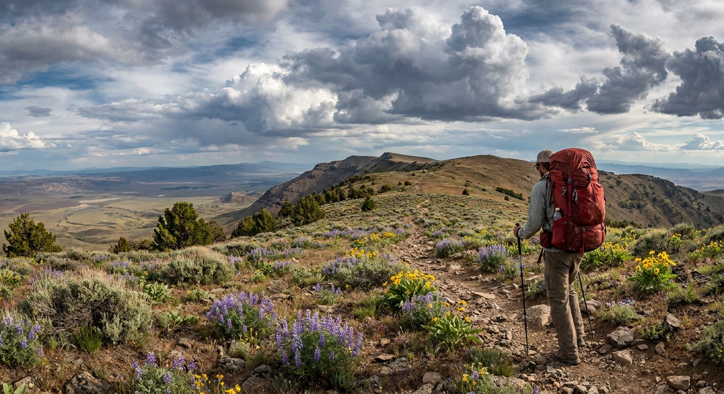
Start early — the Wallowa Lake Trail is well-traveled and the trailhead parking fills fast on summer weekends. The first 6 miles follow the West Fork Wallowa River through old-growth forest. The trail is good and the grade is manageable. After the West Fork junction, the route steepens significantly as you climb toward the alpine zone. Snow can linger on the upper switchbacks into early July.
Glacier Lake sits at 8,230 feet in a granite cirque below the imposing north face of Eagle Cap. Camp on established sites on the east or north shore. Water is everywhere — filter it. Fishing for cutthroat trout can be excellent here. Bring a 4-weight rod and a few small dry flies if you have room in your pack.
Day 2: Glacier Lake to Mirror Lake via the Lakes Basin (7 miles, +800 ft / -1,200 ft)
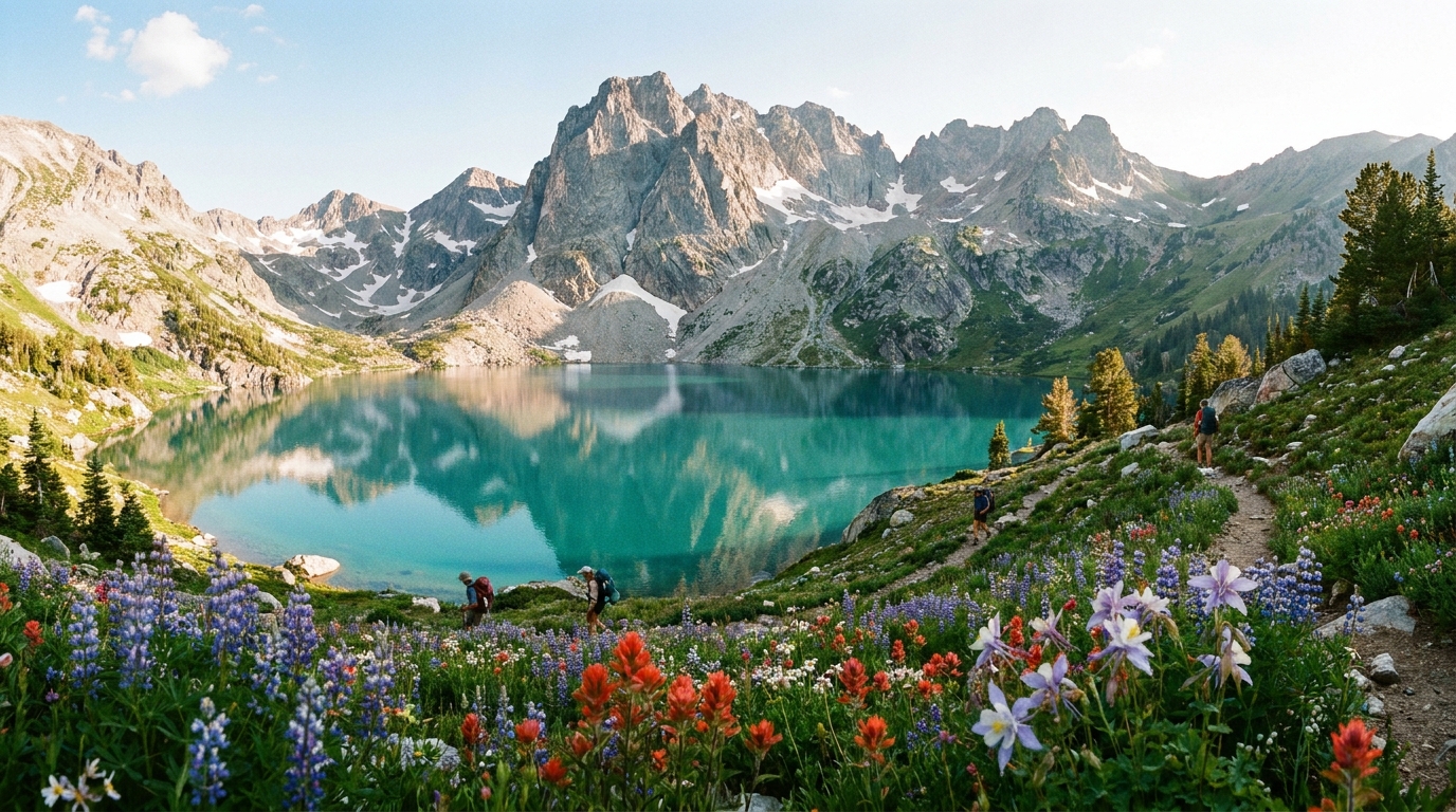
This is the highlight day. The trail from Glacier Lake drops into the main Lakes Basin, where a dozen alpine lakes cluster within a few miles of each other. Side trips to Horseshoe Lake (1.5 miles off route) and Lee's Lake are worth every step — both are stunningly clear and see fewer visitors than the main basin.
The summit of Eagle Cap (9,572 ft) is accessible via a well-marked 1.5-mile trail from the basin. The 360-degree view from the summit — Wallowa Lake glittering below, Idaho's Seven Devils to the east, the Cascade volcanoes on clear days to the west — is one of the best summit experiences in the Pacific Northwest. Allow 2–3 extra hours if you go.
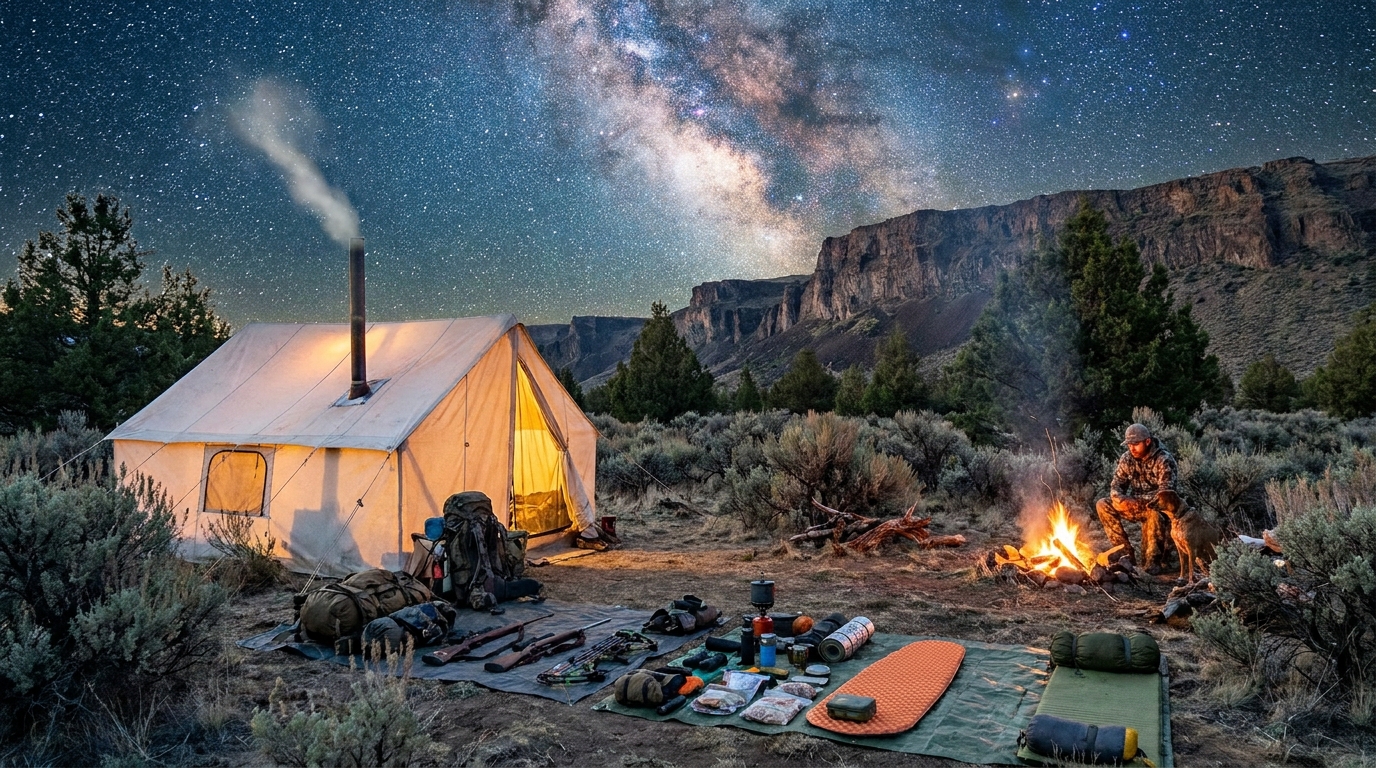
Camp at Mirror Lake or the meadow below Carrotfields. Dispersed camping is allowed throughout the wilderness; practice Leave No Trace and camp at least 200 feet from water.
Day 3: Mirror Lake to Tuck's Flat or Polaris Pass Area (8 miles, +1,400 ft / -1,800 ft)
The route through Polaris Pass is rugged and spectacular. The trail climbs steeply out of the main basin and crosses into the East Lostine drainage. On the far side of the pass, the landscape opens into vast granite slabs and long views. Wildflowers here in late July are extraordinary.
This day has the most route-finding challenge — carry a downloaded topo map in Gaia GPS or CalTopo. The trails are marked but the above-treeline sections require attention. Tuck's Flat and the drainages below the pass offer sheltered camp spots out of the wind.
Wildlife Note
The Eagle Cap Wilderness supports a healthy black bear population. Use a bear canister or hang your food properly every night. Mountain goats are commonly spotted on the cliffs above the main basin — binoculars are worth the weight up here.
Day 4: Return to Wallowa Lake TH (8–10 miles, -2,800 ft)
The return via the East Fork Wallowa River or the Lostine River drainage gives you different country on the way out. The East Fork route is longer but beautiful — it descends through high meadows and old-growth zones with excellent views back toward Eagle Cap.
Alternatively, return the way you came via the West Fork for faster travel. Most fit hikers will finish this day by early afternoon even with a moderate pace.
Gear Notes for the Wallowas
The Wallowas are notorious for rapid weather changes. Afternoon thunderstorms are common from July through August. Build storm time into your schedule and always have rain gear accessible — not buried in your pack.
- Shelter: A 3-season tent with good wind resistance. The basin can funnel gusts even in summer.
- Footwear: Trail runners work fine in dry conditions, but stiff-soled hiking boots give better security on the rocky, talus-heavy terrain above treeline.
- Water: Sawyer Squeeze or similar filter. Water is abundant throughout.
- Navigation: Download the area in Gaia GPS before you leave cell service (which disappears completely once you're past the trailhead parking area).
- Leave No Trace: This wilderness sees heavy summer use. Pack out every scrap of trash, use WAG bags above treeline, and stay on established trails through the fragile alpine meadows.
Getting There
Joseph, Oregon is about 5 hours from Portland or 4 hours from Boise. The Wallowa Lake Trailhead is 6 miles south of Joseph at the south end of Wallowa Lake. Enterprise has the nearest services; stock up before heading to the trailhead. Wallowa Lake State Park has a campground for pre/post-trip nights.
The Eagle Cap Wilderness is one of Oregon's great treasures. If you've been backpacking the Three Sisters or Jefferson Park, and you're ready for something that feels genuinely remote, the Wallowas will deliver.