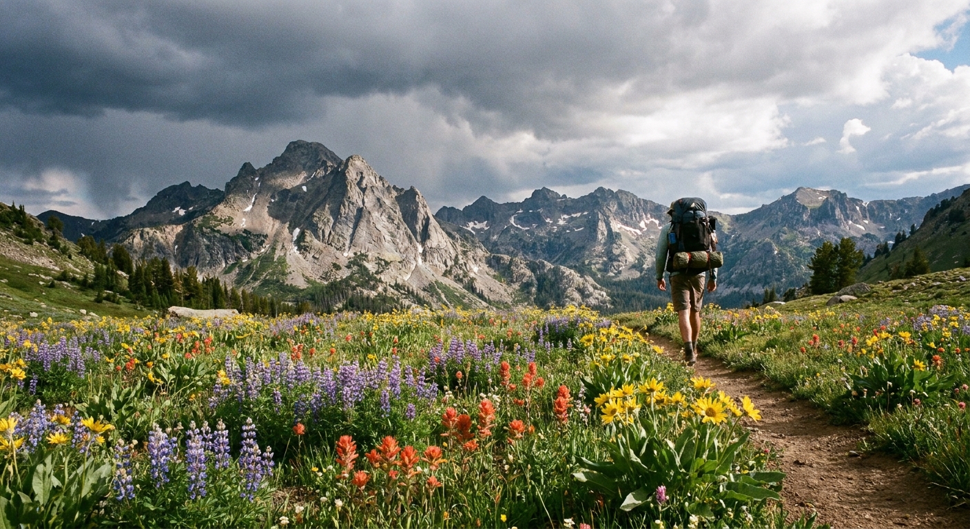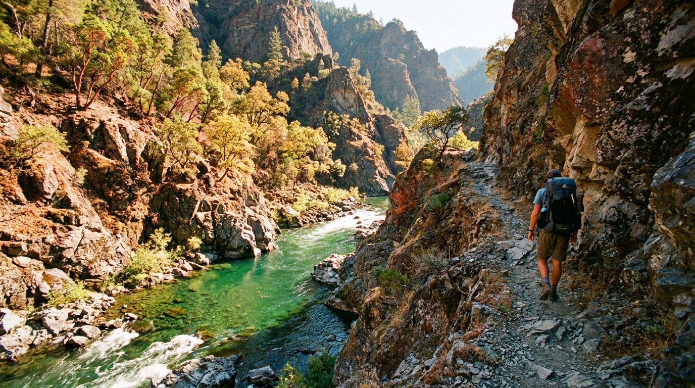
Most Oregon backpackers default to the high Cascades — the Three Sisters, Jefferson, Rainier's shadow. The Rogue River Trail in the Klamath Mountains of southwestern Oregon plays by entirely different rules. There are no glaciers, no alpine lakes, no ponderosa pines. Instead there's a wild green canyon, 3,000-foot walls of old-growth Douglas fir and madrone, swimming holes with the color of glacial melt despite the heat, and one of the most storied wild rivers in the American West.
The full Grave Creek to Agness route covers approximately 40 miles one-way along the Wild and Scenic stretch of the Rogue River. Most backpackers split this into 4–5 days, though fit hikers cover it in 3. The trail is accessible year-round but shines in late spring (May–June) and fall (September–October), when temperatures are moderate and the river is at photogenic levels.
Logistics and Permits
The Rogue River Trail requires a free permit for overnight camping from May 15 through October 15. Permits are issued by the Smullin Visitor Center in Merlin, Oregon. This is a self-registration system managed by the BLM Medford District — pick up your permit at Smullin on the way in. Day use requires no permit.
The most common approach is a point-to-point shuttle. Drop a vehicle at the Illahe Trailhead (or the Foster Bar boat launch just below Agness) and drive to the Grave Creek Trailhead, roughly 3 hours apart. Alternatively, the local shuttle services in Grants Pass can move vehicles for a reasonable fee — worth it if you're traveling solo or with a small group.
Route Overview: Grave Creek to Illahe
Day 1: Grave Creek to Slim Pickens Bar (~9 miles)
The trail begins at Grave Creek Bridge and immediately enters canyon country. The first several miles are relatively gentle, hugging river terraces and dropping in and out of shaded drainages. Marial is the first major landmark — an old homestead and historical area roughly 11 miles in. Camp at Slim Pickens Bar or Kelsey Creek for good river access and flat tent sites.
Day 2: Slim Pickens to Brushy Bar (~10 miles)
This stretch passes through some of the most dramatic canyon scenery on the route. The trail climbs above the river in places, offering sweeping views of the gorge before dropping back to river level. Blossom Bar, one of the most challenging whitewater rapids on the West Coast, is visible from trail. Brushy Bar has an established camp with pit toilet and fire rings — popular with both backpackers and jet boat tours.
Day 3: Brushy Bar to Paradise Bar (~8 miles)
Shorter mileage day by design. The trail passes Tate Creek and several excellent swimming holes in the mid-section of the route. Paradise Bar is arguably the most scenic camp on the route — a wide gravel bar at a river bend with clear, deep water and an established camp managed by the BLM. If you're moving fast, push through to Flora Dell Creek.
Day 4: Paradise Bar to Illahe (~9 miles)
The final section climbs away from the river more frequently as the canyon opens up toward the coast. The vegetation shifts from pure canyon scrub to more Douglas fir and myrtlewood as you approach the tidewater influence. Illahe Trailhead sits at road's end; from there it's a short road walk or arranged shuttle down to Foster Bar and the Rogue River takeout.
Lodges Along the Route
Several backcountry lodges operate within the Wild and Scenic corridor — Paradise Lodge, Black Bar Lodge, Marial Lodge, and Half Moon Bar Lodge among them. These aren't luxury resorts, but they offer a hot meal, a bed, and a cold beer at the end of a hard day. Reservations are required weeks in advance during peak season. Even if you don't stay, some lodges allow drop-in for a meal if they have capacity — worth asking.
Fishing the Rogue
The Wild and Scenic stretch of the Rogue holds excellent populations of summer steelhead (June–October), chinook salmon (fall run), and wild half-pounder steelhead unique to the Rogue drainage. Fishing from the trail with a compact pack rod is entirely viable — a 9-foot 7-weight fly rod breaks down to 18 inches and weighs almost nothing. Work the tailouts and softer water on the inside bends. Check current ODFW regulations carefully; the Wild Rogue has specific closures and gear restrictions in effect at various times of year.
Hazards and Practical Notes
- Rattlesnakes: Pacific rattlesnakes are common in the lower canyon, particularly on rocky south-facing slopes. Watch where you step and where you put your hands on rock scrambles. They're not aggressive but deserve respect.
- Poison oak: Abundant along the lower trail. Long sleeves and pants are strongly recommended even in summer heat. Learn to identify it before you go.
- Water sources: Tributaries are frequent and reliable May through July. By late summer some side creeks run thin — carry capacity for 8–10 miles between sources and filter everything.
- Jet boats: Commercial jet boat tours operate on the river daily. They don't impact the hiking experience but they will appear suddenly around a bend if you're fishing. Be aware.
- Leave No Trace: Camp only at established sites within the permit corridor. The Rogue sees significant traffic and site impact is already visible in high-use areas. Pack out everything.
When to Go
Late May and early June hit a sweet spot: wildflowers are still going, water levels are fishable, temperatures are in the 70s in the canyon, and the crowds haven't arrived yet. The canyon gets genuinely hot in July and August — 95°F days are common — but the swimming holes make it tolerable. October is spectacular for fall color and the start of fall salmon season. Avoid winter; trail sections flood and the permit season is closed anyway.
The Rogue River Trail is one of those routes that doesn't require technical skills, altitude acclimatization, or specialized gear — just a willingness to carry a pack for four days through a canyon that looks and feels like a different Oregon entirely.