Mount Jefferson stands as Oregon's second-highest summit at 10,497 feet, a glaciated stratovolcano that dominates the central Cascades skyline from Bend to Salem. The wilderness that bears its name protects nearly 109,000 acres of alpine terrain — a landscape of obsidian fields, glacier-carved basins, wildflower meadows, and dozens of lakes ranging from hidden tarns to the expansive Pamelia Lake. For backpackers, it offers some of the finest high-country travel in the Pacific Northwest, with route options ranging from simple overnights to technical multi-day loops.
This 3-day loop covers approximately 22 miles and focuses on Jefferson Park — the most celebrated subalpine basin in the wilderness — with enough variation to satisfy hikers who want more than just a straight out-and-back.
Before You Go: Permits and Planning
The Mount Jefferson Wilderness requires a self-issued Northwest Forest Pass for trailhead parking ($5/day or $30 annual). For overnight stays, you need a free wilderness permit, which is self-issued at most trailheads via iron ranger envelope. However, Pamelia Lake — one of the most visited spots in the wilderness — operates under a limited entry permit system from May 15 through October 31. A set number of overnight permits are issued per day; reserve them at Recreation.gov well in advance (often months ahead for summer weekends).
If you're entering via the South Fork Breitenbush Trail to Jefferson Park, no quota currently applies — a legitimate advantage of routing from the north side. Always check current permit requirements with the Detroit Ranger District before your trip.
The Route
Trailhead: South Fork Breitenbush (Forest Road 4685)
Access from Detroit via FR 46 (Breitenbush Road) north, then east on FR 4685 to the trailhead at approximately 3,600 feet elevation. The road is generally passable to standard vehicles after snowmelt — confirm road conditions with the Detroit Ranger District, as FR 4685 is not always maintained early in the season.
Day 1: South Fork Breitenbush TH to Jefferson Park (8 miles, +2,400 ft)
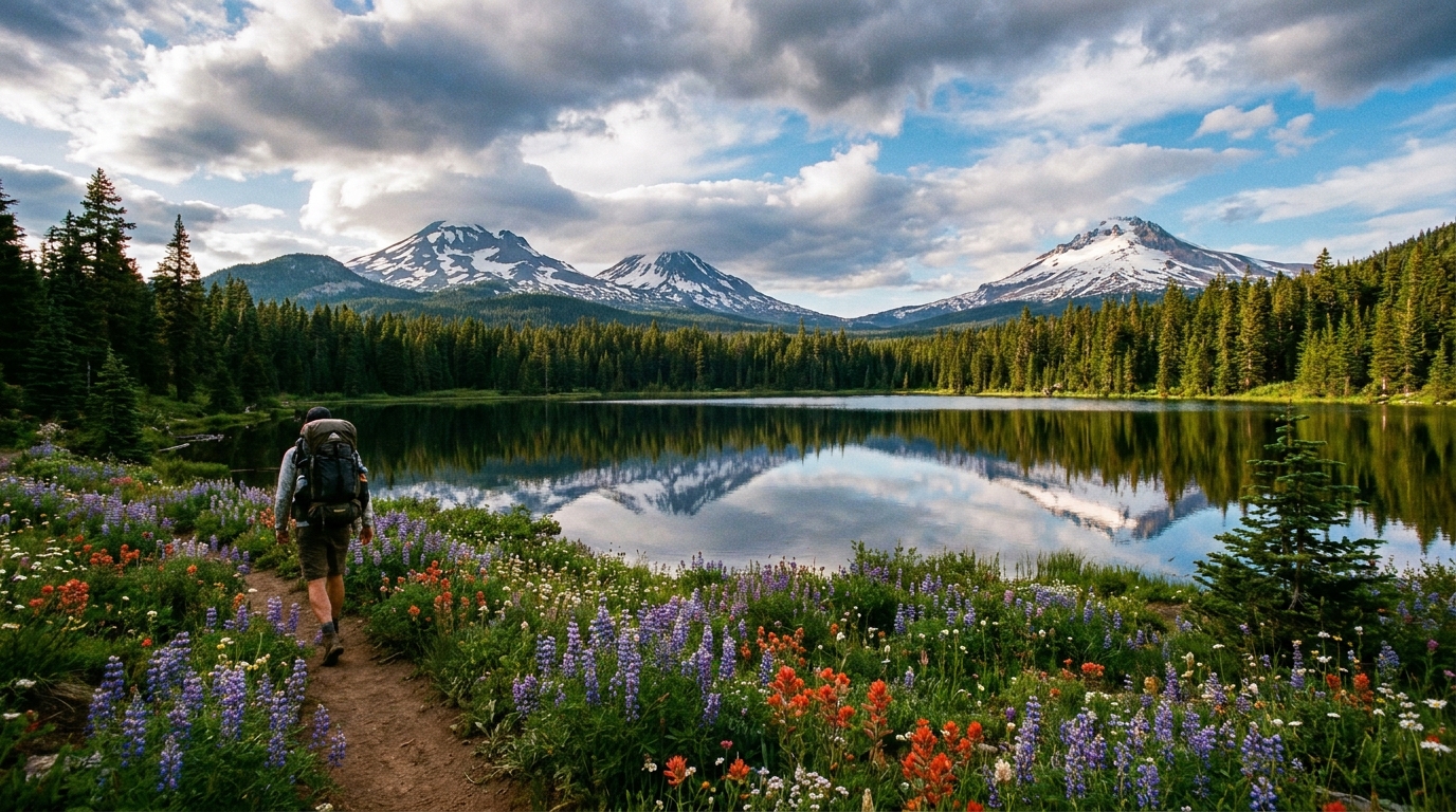
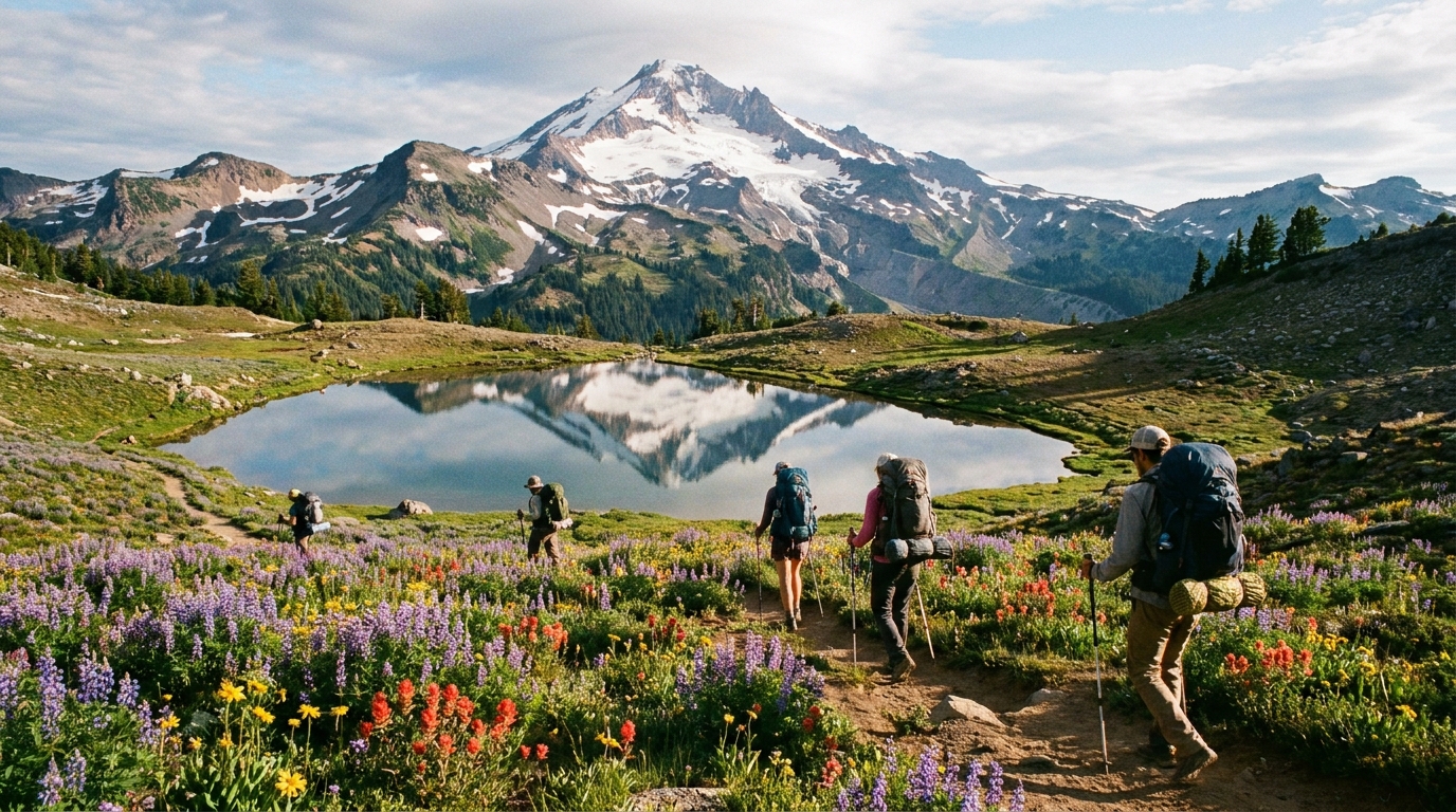
The South Fork Breitenbush Trail (Trail 3375) climbs steadily through old-growth Douglas fir and western hemlock before entering the subalpine zone at around 5,500 feet. The gradient is consistent — never brutally steep — but the sustained climb on a loaded pack will be felt. At approximately 7 miles, you break out of the trees and the landscape opens dramatically: Jefferson Park.
Jefferson Park is one of those rare wilderness destinations that matches its reputation. At roughly 6,000 feet, it's a broad, flower-filled plateau holding Russell Lake, Scout Lake, Bays Lake, and a dozen smaller tarns, all backdropped by the dramatic south face of Mount Jefferson and its hanging glaciers. In late July and early August, the wildflower display — paintbrush, lupine, penstemon, and heather — is genuinely stunning.
Camp regulations in Jefferson Park are strict and should be followed carefully: no camping within 100 feet of any water source, no camping in the meadows, and fires are prohibited above 4,500 feet (carry a stove). Established tent sites on the mineral soil benches between the lakes fill on summer weekends but are typically available midweek.
Day 2: Jefferson Park Exploration and Pacific Crest Trail South (8 miles, moderate terrain)
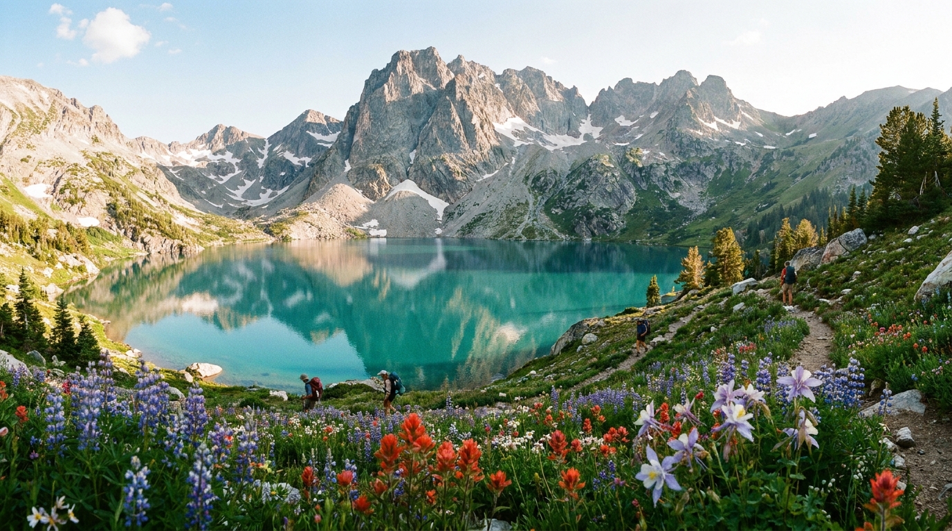
Spend the morning exploring Jefferson Park at a relaxed pace. Scout Lake offers the most dramatic Jefferson reflection in calm morning conditions; Russell Lake is larger and better for a cold swim (bring willpower). From the PCT junction in the park, a side trail leads north toward Whitewater Creek — walk it a mile for views back across the basin and down into the West Fork drainage.
In the afternoon, pick up the Pacific Crest Trail heading south from Jefferson Park. The PCT here traverses the western ridge of the Cascade crest through open pumice flats and scattered mountain hemlock, with consistent views east toward the high desert. After approximately 5 miles, drop to Shale Lake basin for your second night — a quieter alternative to Jefferson Park with excellent camping and fewer crowds.
Wildlife note: Black bears are active in Jefferson Park through the summer. Use a bear canister or hang your food properly. The park also holds mountain goats on the rocky slopes above treeline — binoculars are worth carrying.
Day 3: Shale Lake to Pamelia Lake TH and Shuttle (6 miles, -1,800 ft)
The final day drops south and west via the Hunts Cove trail system toward Pamelia Lake, Oregon's largest natural lake in the wilderness at just over 3,800 feet. The descent through old-growth is steep in places but well-maintained. Pamelia Creek runs clear and cold alongside the lower trail.
Exit via the Pamelia Lake Trail (Trail 3439) to the Pamelia Lake Trailhead on FR 2246. This requires either a car shuttle (recommended) or a road walk back to the South Fork Breitenbush TH — about 8 additional miles on forest roads if you're without a second vehicle. Many parties arrange a shuttle with a local outfitter or simply leave a bike at the exit trailhead.
What to Pack for This Route
- Water treatment: Pumps, filters, or chemical tabs — water is abundant but giardia is present
- Layers: Even in August, Jefferson Park nights can drop below freezing. A puffy and rain shell are non-negotiable.
- Sun protection: The open pumice terrain above treeline offers no shade. High-SPF sunscreen, sun hat, and UV sunglasses.
- Navigation: Download offline maps on Gaia GPS or CalTopo before you lose cell service. The Green Trails Map #557 (Mount Jefferson) covers the route.
- Bear canister or hang system: Required for responsible camping in Jefferson Park
- First aid kit: The nearest trailhead is several miles from any camp; self-sufficiency matters
Best Time to Go
The Jefferson Park area is typically accessible from late July through early October, though snow can linger on north-facing slopes through August in high snow years. Wildflower peak runs late July to mid-August. For solitude, aim for a Tuesday-Thursday start in August or early September. Weekend crowds in Jefferson Park from late July through Labor Day are significant — the area's reputation is well-earned, and it shows in the foot traffic.
Fall is increasingly underrated: the crowds thin dramatically after Labor Day, the huckleberries ripen across the lower flanks, and the light on Jefferson's glacier-draped face in September is extraordinary. The trade-off is shorter days and a higher probability of early-season weather. Pack for it and you'll often have the park to yourself.
Leave It Better Than You Found It
Jefferson Park shows clear signs of overuse in some areas — compacted soil, eroded social trails, damaged vegetation. Stick to established campsites, pack out everything including food scraps and biodegradable waste, and spread your footprint as little as possible. The wilderness that O'Connor and his contemporaries wrote about will only survive if each generation treats it with more care than the last.