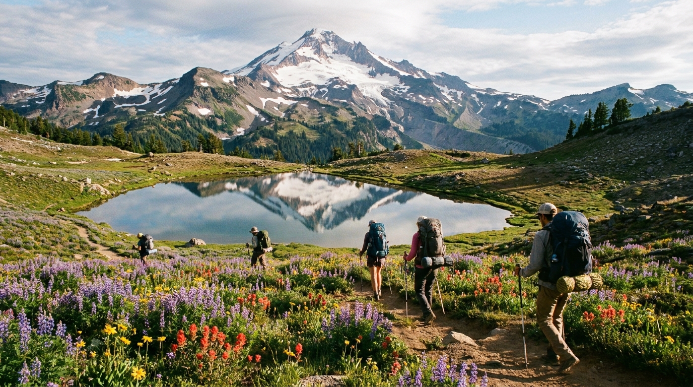
Few loops in Oregon match the Timberline Trail for concentrated alpine spectacle. This 40-mile route circles Mount Hood completely, threading through wildflower meadows, across glacier-fed rivers, past lava fields and ice-streaked headwalls, and through old-growth forest that gives way to open subalpine terrain above 6,000 feet.
Most fit backpackers complete it in 3–4 days. It's not technically difficult — no technical climbing required — but the river crossings, elevation gain (roughly 8,000+ feet cumulative), and route-finding at higher elevations demand solid preparation.
When to Go
The Timberline Trail is typically snow-free from mid-July through September. Late June conditions are possible in low-snow years, but glacier-fed crossings are typically at their most dangerous in late June and early July when snowmelt is at peak.
The sweet spot for most hikers is early August through mid-September. Wildflowers peak in late July and early August. Huckleberry season runs August–September. Crowds thin considerably after Labor Day weekend, and conditions remain excellent through the end of September in most years.
Permits and Regulations
As of 2024, the Timberline Trail does not require an overnight wilderness permit in most conditions, but regulations can change. Check current Mt. Hood National Forest regulations before your trip at recreation.gov.
You will need:
- A Northwest Forest Pass for trailhead parking (available at recreation.gov or most outdoor retailers)
- A valid fire permit if you plan to use a camp stove above 4,800 feet (free; sign for one at the trailhead)
Camping is allowed throughout the Mount Hood Wilderness. Stay 200 feet from lakes, streams, and trails. Campfires are generally prohibited above 4,800 feet — carry a stove.
Trailheads and Starting Points
Most hikers start at Timberline Lodge (6,000 ft elevation) on the south side of the mountain. This is the most accessible starting point and puts you at the high point of the route almost immediately.
Other starting options:
- Cloud Cap Saddle Campground (north side): Great start for clockwise loops, avoids the crowded Timberline Lodge area on day one.
- Ramona Falls Trailhead (west side): Lower elevation start, good for hikers preferring to build elevation gradually.
The Crossing Problem: Sandy River and Eliot Branch
The two historically difficult crossings on the Timberline Trail are the Sandy River (west side) and Eliot Branch/Coe Branch (north side). Both are glacier-fed and can be knee- to thigh-deep in early season.
Sandy River: A log bridge has been in place in recent seasons, but glacial outburst events have destroyed it repeatedly. Check current conditions at the Mt. Hood National Forest ranger station or on the Oregon Hikers Forum before you go. Trekking poles are essential.
Eliot Branch/Coe Branch: These north-side crossings drain the Eliot Glacier — the largest glacier on Hood — and can be genuinely dangerous in early season. After mid-August, they're typically manageable at shin- to knee-depth with trekking poles and careful foot placement.
Always cross early morning: Glacial rivers run coldest and lowest in the early morning hours before the day's sun hits the ice. Time significant crossings for 7–9 AM when possible.
Route Overview (Clockwise from Timberline Lodge)
- Timberline Lodge → White River Canyon (5 miles): Across the White River glacier outwash. Excellent views, manageable crossing on rocks in most conditions.
- White River → Cloud Cap (8 miles): The high north-facing traverse. Barret Spur junction offers a side trip to 7,800 ft with full Eliot Glacier views. Eliot Branch crossing here.
- Cloud Cap → Ramona Falls (12 miles): Descent through old-growth on the west side. Ramona Falls side trip worth 30 minutes. Sandy River crossing here.
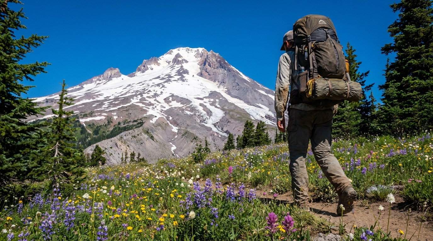
- Ramona Falls → Paradise Park → Timberline (10 miles): The finale. Paradise Park in mid-August is extraordinary — a broad meadow of paintbrush, lupine, and bistort at 6,000 feet directly below the Zigzag Glacier.
Best Campsites
- McNeil Point: The best campsite on the mountain, full stop. Rock shelters, 360° views, and sunset light on the north face. Arrive by 3 PM on summer weekends to get a spot.
- Elk Cove: A sweeping meadow beneath the Eden Park headwall on the north side. Excellent water availability and some of the best wildflower displays on the loop.
- Cathedral Ridge: Broad ridge camp with good wind protection and views toward Adams and Rainier on clear days.
- Paradise Park: The spectacular meadow on the southwest side. Dispersed camping available throughout. No established sites — flat ground is your friend.
Gear Notes for Hood
Mount Hood's weather is notoriously variable. The summit generates its own storm systems, and afternoon thunderstorms can materialize above 5,000 feet within 30 minutes. Rain gear is not optional — even in August. A lightweight waterproof shell weighs almost nothing and can make a miserable afternoon manageable.
Night temperatures regularly drop below freezing at higher camps even in August. A sleeping bag rated to at least 20°F is recommended. Trekking poles are near-mandatory for the river crossings — they provide a critical third contact point in fast-moving water and take significant load off your knees on the descent from Cloud Cap.
Wildlife
Black bears are present throughout the Mount Hood Wilderness. Use a bear canister or hang food properly — this isn't optional near established camps like McNeil Point and Elk Cove where bears have learned to associate campsites with food. A BearVault BV500 or Ursack Major XL handles a 3-day food supply comfortably.
Marmots are everywhere above treeline and are comically unafraid. Don't feed them. They'll gnaw your pack straps for the salt if you leave gear unattended.
The Timberline Trail around Mount Hood is one of Oregon's defining outdoor experiences — a route that offers everything this state's wilderness has to offer inside a single, manageable loop. Plan carefully, go prepared, and it'll rank among your best.