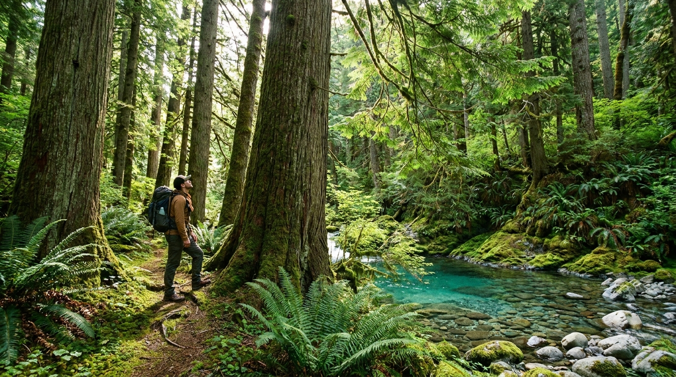
There are old-growth forests in Oregon, and then there is Opal Creek. Tucked into the Little North Santiam River drainage in the western Cascades, the Opal Creek Wilderness preserves roughly 35,000 acres of ancient lowland forest that escaped the chainsaw by the skin of its teeth — saved in 1996 after one of the most contentious conservation battles in Oregon history. The trees here are enormous: Douglas fir and western red cedar that were already old when European settlers arrived, standing in a cathedral silence broken only by water and birds.
For backpackers within driving distance of the Willamette Valley, Opal Creek deserves a spot on the permanent rotation. It's accessible, relatively gentle by Cascade standards, and offers a quality of forest experience that you simply cannot replicate elsewhere in western Oregon.
Getting There
The primary trailhead for Opal Creek is the Jawbone Flats trailhead, accessed via Little North Fork Road from Mehama (on Highway 22, east of Salem and Stayton). The drive from Salem takes roughly 60–70 minutes; from Portland, plan on 90 minutes. Forest roads are generally passable for standard passenger vehicles in dry conditions, though the last few miles are gravel.
Note: A Northwest Forest Pass or America the Beautiful Pass is required for trailhead parking. Purchase online through Recreation.gov or at ranger stations in Salem or Detroit.
Permits and Season
The Opal Creek Wilderness does not currently require a timed-entry permit (unlike some other popular Oregon wilderness areas), but check with the Willamette National Forest Detroit Ranger District before your trip as regulations can change. The best backpacking season runs from late May through October; the trail is open earlier in low snow years, and the ancient forest provides rain shelter for shoulder-season trips in April and November.
The Route: A 2-Night Loop
This route covers approximately 14 miles with 1,800 feet of elevation gain — a weekend trip comfortable for hikers of moderate fitness. You'll pass through Jawbone Flats (a historic mining townsite), reach the jewel-clear pools at Opal Pool, and camp in old-growth stands along the Little North Santiam River.
Day 1: Trailhead to Jawbone Flats (4.5 miles)
The trail from the gate at the trailhead follows an old road grade through increasingly impressive forest as you move up-valley. Within the first mile you're among big timber — the transition from second-growth to old-growth is visible and dramatic. Watch for yellow-spotted millipedes on the trail surface (harmless, abundant, and fascinating) and listen for the winter wren's impossibly complex song in the undergrowth.
Jawbone Flats, at mile 4.5, is a collection of historic mining-era buildings maintained by the Friends of Opal Creek. Some structures are open for interpretation. Camp here on your first night — established campsites near the river, reliable water from the Little North Santiam, and proximity to the Opal Pool day hike. Fires are permitted in established fire rings at Jawbone Flats (check current fire restrictions).
Day 1 Afternoon: Opal Pool Side Trip (1.5 miles round trip)
Drop your pack at camp and make the short hike to Opal Pool. The pool is fed by Opal Creek, and the water clarity that gives it its name is genuine — the tannin-free, cold water over pale greenish rock produces a color that looks edited. Swimming is permitted and, in summer, irresistible. In late May or early June, the water is cold enough to be bracing but the forest setting makes it worth it.
Day 2: Jawbone Flats to Battle Ax Creek Area (4 miles)
From Jawbone Flats, the trail continues up the drainage past increasingly massive cedar and fir. The second growth of the lower valley gives way entirely here to trees with 8–12 foot base diameters and moss carpets you could sleep on. The forest floor stays cool even on hot summer days — the canopy is that complete.
Camp in the Battle Ax Creek drainage, where several established dispersed campsites sit along the creek. Water is plentiful; treat it with a filter or purification tablets as a standard practice. This section of trail sees less traffic than the lower valley, and you're likely to have the evening to yourself.
Day 3: Return to Trailhead (4 miles)
Return the way you came for a straightforward finish, or — if you planned a car shuttle or have a willing driver — continue to the Cedar Flats Research Natural Area before exiting. The return hike from Battle Ax Creek to the trailhead moves quickly on the downhill grade and gives you a second look at the big trees with fresh eyes.
Gear Notes for Opal Creek
- Rain gear, always: The western Cascades receive over 100 inches of annual precipitation. Even in summer, afternoon thunderstorms are possible. Pack a waterproof rain jacket and pants, full stop.
- Bear canister: Black bears are present and active in the drainage. Use a bear canister (BearVault BV500 or Ursack Major) or hang your food properly. Do not leave food in your tent or unattended on the ground.
- Gaiters: The forest floor is wet, the undergrowth brushes the trail, and morning dew on vegetation is heavy. Low gaiters keep socks dry.
- Trekking poles: Several stream crossings exist in the upper drainage; poles provide stability on slippery mossy rocks.
- Insect repellent: June and July can bring significant mosquito pressure, particularly near camp in the evenings. DEET or Picaridin-based repellents work best.
Leave No Trace in Old-Growth
The fragility of old-growth forest ecosystems deserves particular care. The moss mats, nurse logs, and shallow root systems of ancient trees are easily damaged by off-trail travel. Stay on the trail. Camp only in established sites. Do not collect or remove any wood — every fallen log in this forest is a critical habitat element. If you carry it in, carry it out, including all food waste and gray water disposal away from water sources.
The Friends of Opal Creek (friendsofopalcreek.org) maintain the Jawbone Flats facilities and advocate for the wilderness. Consider a membership — it's one of the most direct ways to support continued access and stewardship of this place.
Combining Opal Creek with Nearby Options
If you have more time, the Opal Creek Wilderness connects to the Bull of the Woods Wilderness to the east. A multi-day traverse from Jawbone Flats through to the Battle Ax summit area and into the Bull of the Woods covers serious old-growth territory and reaches above-treeline terrain with views of the central Cascades. This is a more committing 4–5 day route requiring solid navigation skills.
Detroit Lake, 15 miles east on Highway 22, offers easy car camping with boat ramp access if you're doing a dual-purpose trip combining backpacking with lake fishing for kokanee and rainbow trout.
Why Opal Creek Matters
Less than 10% of the original old-growth forest of the Pacific Northwest remains. What's left exists in fragments, most of it in designated wilderness areas like this one. Walking through Opal Creek is walking through a version of the Northwest that was once everywhere from the coast to the Cascades. The size, age, and ecological complexity of these trees — Douglas firs and cedars that are 500 to 1,000 years old — is something you cannot intellectualize in advance. You have to stand inside it.
That experience, 60 miles from a major metro area, accessible to hikers of all ages and abilities, is among the most remarkable things about Oregon's public lands. Get out there.