Southeast Oregon gets overlooked. Most Oregon hikers know the Wallowas, the Cascades, the Sky Lakes. They've heard of the Steens. But the Pueblo Mountains — a fault-block range rising steeply from the Alvord Desert floor — remain genuinely unknown outside of a small circle of high-desert addicts, and that obscurity is one of their best features. On a three-day route through the Pueblos, you can cover alpine ridgelines, volcanic plateau, canyon streams, and the sweeping basin-and-range topography of the Great Basin without seeing another soul. July is prime time: snowpack is gone from the upper routes, wildflowers are peaking, and the heat at the Alvord is still bearable in the morning hours when you want to be moving.
The Range: What You're Walking Into
The Pueblo Mountains are managed by the BLM Burns District and top out at 8,634 feet at Pueblo Mountain itself — a prominence visible from the Fields-Denio Road that rises nearly 5,000 feet above the Alvord Desert. The range extends roughly 35 miles north to south and contains a mix of sagebrush steppe, aspen-lined creek drainages, and above-timberline plateau that looks more like Nevada than Oregon. There are no designated wilderness areas here, no maintained trails on the upper portions of the range, and minimal signage. You navigate with topo maps, a compass, and the confidence to read terrain.
This is not a beginner trip. But it's not a technical climb either. Strong hikers comfortable with cross-country navigation and self-sufficiency in remote conditions will find the Pueblos extremely rewarding.
Three-Day Route: Denio Junction to Fields via Pueblo Mountain
Day 1: Trailhead to Domingo Pass (8–10 miles)
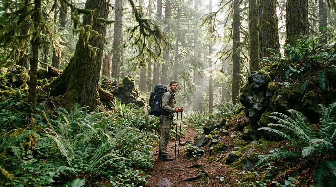
The standard starting point is the Denio Junction area on the south end of the range. Park at the informal trailhead off the Fields-Denio Road and follow the Domingo Creek drainage northwest into the mountains. The first several miles follow a faint two-track and then a use trail along the creek through willow and aspen. Water is reliable here through July — filter everything but camp near the creek without concern for water scarcity.
As you gain elevation, the drainage opens into a broad plateau north of the summit block. Wildflowers in late June and July are exceptional here — bitterroot, penstemon, Indian paintbrush, and patches of late-season snow. Make camp on the plateau at around 7,200 feet, where wind is manageable and the views east to the Alvord are spectacular at sunset.
Day 2: Summit Attempt and Plateau Traverse (10–12 miles)
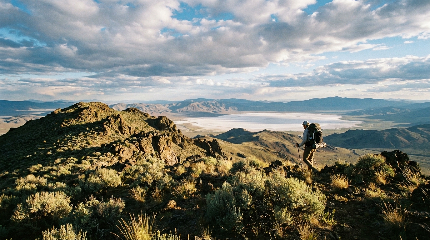
Start early — the summit approach is straightforward from the plateau but the desert heat accelerates significantly by 10 AM. Leave camp at first light and ascend the south ridge of Pueblo Mountain. The route is cross-country; stay on the ridge crest and navigate around volcanic rock outcroppings. Summit views extend to the Steens Mountain massif to the north, the Black Rock Desert in Nevada to the south, and the Alvord Desert shimmering below to the east. On a clear July morning, you can see well over 100 miles in multiple directions.
After tagging the summit, traverse north along the plateau toward Van Horn Basin. The terrain is open sagebrush plateau with intermittent rocky outcroppings. Navigation is by ridge and basin — stay high and follow the plateau until it drops toward the north end of the range. Camp at Van Horn Basin near the seasonal creek, which typically holds water through July but can be thin in dry years. Filter and treat everything.
Day 3: Descent to Fields (7–9 miles)
Descend the north drainage toward the small community of Fields on the west side of the Alvord Desert. The route drops through sagebrush and bunchgrass before reaching the Fields-Denio Road. Arrange a vehicle shuttle in advance — Fields is roughly 35 miles north of Denio Junction by road, so you'll need two vehicles or a willing shuttle driver to complete the traverse. The Fields Station store is legendary for its milkshakes, and after three days in the Pueblos, you'll understand why its reputation has spread to every desert hiker in the Pacific Northwest.
Logistics and Practical Notes
- Water: Reliable in Domingo Creek and at Van Horn Basin through July. Carry capacity for 4–6 hours of dry hiking on the summit plateau — there's no water above 7,500 feet
- Permits: None required — BLM land, no fees, self-registration at the informal trailhead kiosk
- Maps: Download the Pueblo Mountain and Van Horn Basin quads from CalTopo or Gaia GPS. Cell service is essentially nonexistent
- Wildlife: Pronghorn antelope on the lower slopes, mule deer on the upper plateau, abundant raptors including golden eagles and prairie falcons. Rattlesnakes are present on the lower desert approaches — watch your step at dawn and dusk
- Nearest services: Fields, Oregon (population ~100) has gas, a small store, and the milkshake counter. Burns is 2+ hours north for anything else
- Cell service: None in the range. File a trip plan with someone reliable before you leave
Why Go Now
The Pueblo Mountains are genuinely one of Oregon's best-kept secrets for high-desert backpacking. The combination of alpine summit, basin-and-range geology, desert basin views, and complete solitude is hard to match anywhere in the state. July hits the sweet spot: the snow is gone, the wildflowers are peak, and the summer crowds that hit Crater Lake, the Wallowas, and the Three Sisters haven't found this place and probably never will. That's the whole point.
Go before they do.