Pull up a map of northeast Oregon and trace the Blue Mountains into Washington. That long strip of designated wilderness straddling the state line — roughly 177,000 acres of ridge, canyon, and high meadow — is the Wenaha-Tucannon. It's one of Oregon's least-visited wilderness areas and one of its most rewarding. If your experience with Blue Mountain backpacking begins and ends with the popular Eagle Cap corridor, the Wenaha-Tucannon will reset your expectations for what remote actually feels like.
Why So Few People Go
The Wenaha-Tucannon is not easy to reach. There's no single obvious gateway town, trailheads require long drives on forest roads, and the terrain — deep river canyons with walls rising to bald ridges above 6,000 feet — is physically demanding. There are no alpine lakes as photogenic as those in the Wallowas, no iconic peaks that draw peak-baggers. The wilderness rewards a different kind of interest: solitude, wildlife, big views across rolling forested mountains, and the particular satisfaction of a place that hasn't been discovered by the Instagram crowd.
It also holds some of the best elk habitat in Oregon. The Wenaha-Tucannon sits within ODFW's Eastern Oregon elk management zone, and the backcountry ridges carry healthy populations of Rocky Mountain elk. Deer, black bear, and mountain lion are present as well. For hunters who want to scout on foot, this is one of the most productive summer reconnaissance destinations in the state.
Access and Trailheads
Oregon-side access is primarily through the town of Troy (population: small) on the Grande Ronde River, reached via Highway 3 south from Lewiston, Idaho, or via Elgin and a long forest road drive. The Troy Trailhead is the standard launch point for the Wenaha River drainage, which runs east to west through the heart of the wilderness before meeting the Grande Ronde.
Washington-side access enters the Tucannon drainage from the north, primarily from Dayton, Washington. Many through-routes cross the state line, and Oregon-to-Washington traverses are popular among more experienced backpackers.
A Umatilla National Forest Motor Vehicle Use Map (available at the Pomeroy Ranger District or printable from the Forest Service website) is essential for navigating the approach roads.
A 3-Day Route from Troy
Day 1: Troy Trailhead to Crooked Creek (8 miles)
The Wenaha River Trail begins in ponderosa pine and cottonwood at the river's edge and climbs steadily into the canyon. The trail is well-maintained in its lower sections and gains elevation through several switchback pitches. Camp near Crooked Creek, where a reliable water source and open area make for a comfortable first night. Expect deer in the early morning on the canyon benches above camp.
Day 2: Wenaha River to Timothy Flats (10 miles)
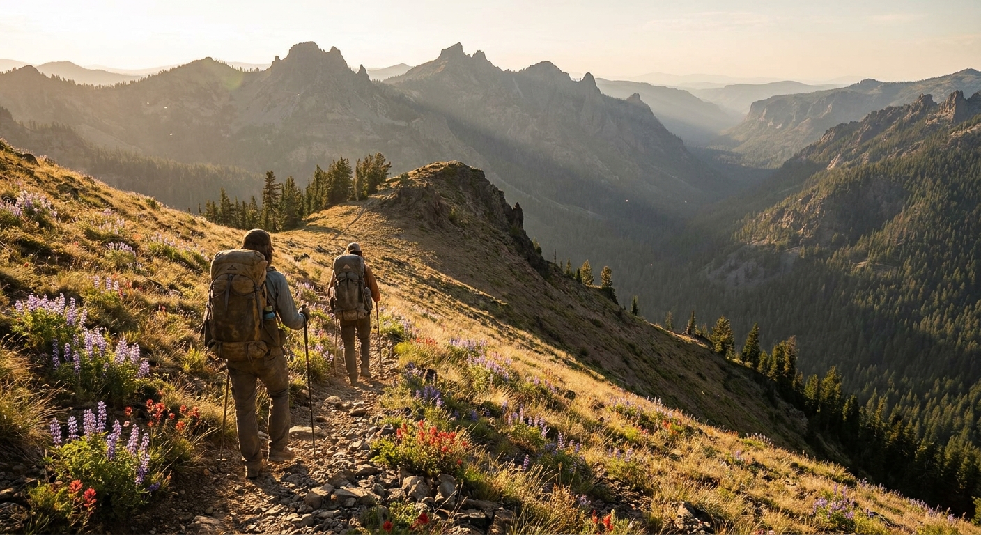
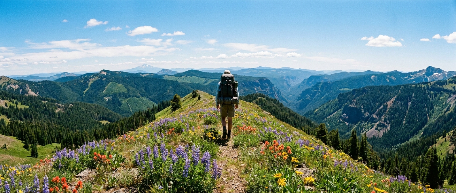
This is the big day. The trail continues up the Wenaha drainage and eventually climbs to the high rim at Timothy Flats, where the character of the wilderness changes completely. Below the rim it's canyon country — timber, steep walls, rushing water. Above it opens into sweeping high meadow with views across the rolling Blue Mountain ridges into Washington. Camp anywhere on the flats; water sources are seasonal but reliable in early and mid-summer. This is elk country. Glass the meadow edges at dawn and dusk.
Day 3: Timothy Flats to Oregon Butte and Return (9 miles)
Oregon Butte, at 6,401 feet, is the highest point in the Wenaha-Tucannon and carries a historic fire lookout. The summit view on a clear day extends across the Blue Mountains into the Wallowas and north into Washington. Return the way you came, or arrange a shuttle for a one-way route into Washington's Tucannon drainage — a significantly longer undertaking that requires a second vehicle at Panjab Creek Trailhead near Dayton, WA.
Gear and Planning Notes
- Water: The Wenaha River and its tributaries provide reliable water through July. Higher reaches dry earlier in drought years — carry capacity for at least 4 miles between sources on the upper sections.
- Weather: July and August bring afternoon thunderstorms to the high country. Get to camp early. Lightning on the open flats is a real hazard.
- Wildlife: Black bears are present throughout. Standard food hanging or bear canister protocol applies. Rattlesnakes inhabit the lower canyon sections — watch where you put your hands and feet on rocky trail sections.
- Permits: No overnight permit system is currently in place for the Wenaha-Tucannon. Self-issued wilderness use permits are available at the trailhead. Check current status with the Pomeroy Ranger District (509-843-1891) before your trip.
- Maps: Nat Geo Trails Illustrated #886 (Hells Canyon NRA / Joseph) covers the southern approach. CalTopo with downloaded USGS 7.5-minute quads is recommended for the high country sections.
The Bottom Line
The Wenaha-Tucannon is not a wilderness that gives itself up easily, and that's precisely the point. The approach is long, the terrain demands fitness, and the rewards — solitude, wildlife, and high country that feels genuinely untrammeled — go to those willing to make the drive and put in the miles. For Oregon backpackers who've exhausted the popular circuits and want something that still feels like discovery, the Wenaha-Tucannon delivers every time.